Maps Cannot Legalise Military Occupation: Why Unilateral Cartography Cannot Rewrite International Law
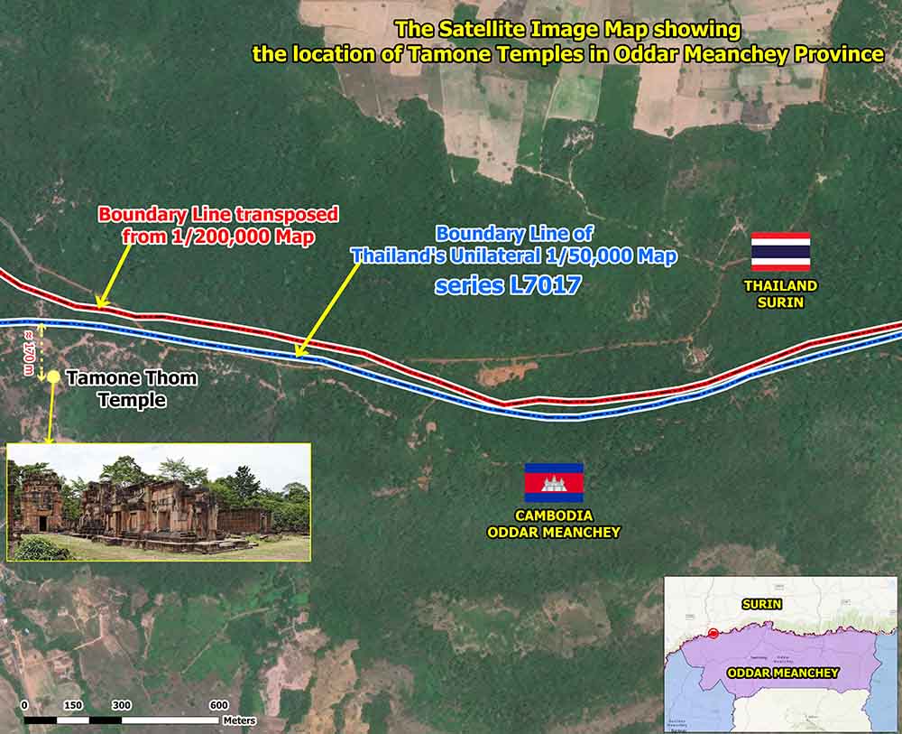
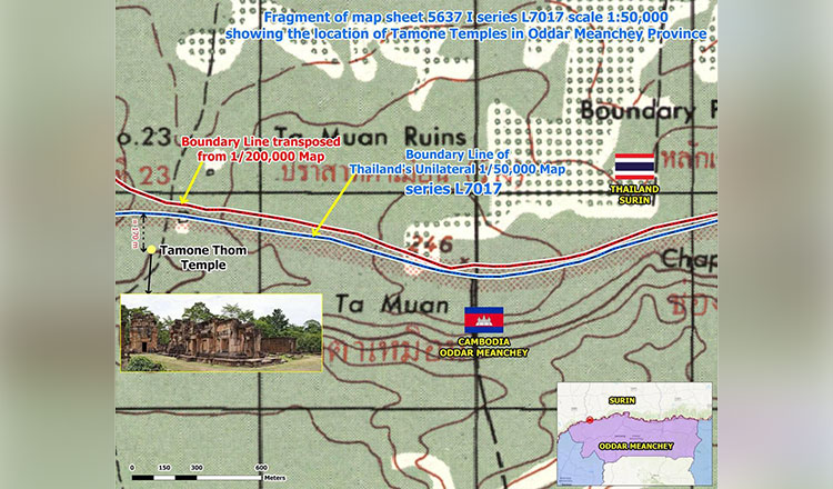 Photo: -Ta Moan Thom Temple sits within Cambodian territory, based on the 1:200,000-scale map, the 1908 and 1919 Indochina-Siam commission boundary-marking minutes, and Thailand’s unilaterally drawn 1:50,000-scale L7017 map. SSBA
One of the oldest methods of territorial expansion is not always carried out with tanks or artillery. Sometimes it begins with a map.
A government first redraws a boundary according to its own interpretation. It then declares that territory lying beyond the internationally recognised border has always belonged to it. Finally, when its armed forces move into that territory, it insists that no invasion has taken place because, according to its own map, its troops have never crossed an international boundary.
This is the logic that Cambodia rejects in the current border dispute with Thailand.
Thai military authorities have repeatedly denied allegations that they entered Cambodian territory, arguing instead that their troops remain within what Thailand considers its own territory under Thai military maps. Such claims may resonate domestically, but they cannot determine international borders. International law does not allow any State to define the limits of its sovereignty by drawing its own maps and then using those maps to justify military action.
If such a principle were accepted, the international legal order established after the Second World War would quickly collapse.
Territorial sovereignty is not created by unilateral cartography. It is established through treaties, mutually agreed boundary delimitation, consistent international recognition, and where necessary, decisions of competent international courts and tribunals. Maps may serve as evidence in determining a boundary, but they do not themselves create legal title, particularly when they are prepared unilaterally by one of the parties to a dispute.
This distinction is fundamental. If a State could acquire territory simply by publishing new maps, every international border in the world would become subject to unilateral revision. International peace would no longer depend upon law but upon whichever country possessed the greater military strength or the louder political narrative.
Cambodia’s legal position has never rested solely upon maps prepared by Cambodia. It rests upon the 1904 and 1907 Franco-Siam Treaties, the work of the Franco-Indochina-Siam Boundary Commission, the internationally recognised 1:200,000 boundary maps produced pursuant to those treaties, and the jurisprudence of the International Court of Justice. These instruments form part of an internationally recognised legal framework that has governed the land boundary between the two countries for decades.
Thailand, however, has increasingly relied upon its own unilateral military maps to support territorial claims that Cambodia does not recognise. From Cambodia’s perspective, these maps cannot alter treaty boundaries or create legal sovereignty over territory that has already been delimited under international law.
Indeed, an irony lies at the heart of the present dispute.
Cambodian border authorities have pointed out that Thailand’s own L7017 military map reportedly places certain disputed Khmer temples, including Ta Mone Thom, within Cambodian territory. If this interpretation is correct, it raises an obvious question: if Thailand’s own historical military mapping does not support its current military position, on what legal basis can continued occupation be justified?
The answer cannot simply be newer unilateral maps or revised military interpretations. No State possesses the legal authority to rewrite an international boundary through domestic cartographic revisions. Sovereignty cannot expand every time a national mapping agency publishes a new edition.
Equally important is the principle governing the use of force.
Article 2(4) of the Charter of the United Nations prohibits the threat or use of force against the territorial integrity or political independence of any State. This principle exists precisely to prevent territorial disputes from being settled through military means.
International law has consistently rejected the acquisition of territory by force.
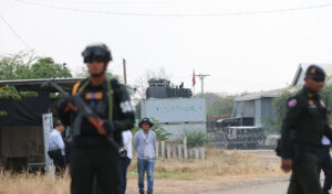
Military occupation, regardless of its duration, does not by itself confer lawful sovereignty. Building military positions, installing barbed wire, placing containers, constructing roads, or establishing defensive infrastructure cannot convert disputed or occupied territory into sovereign territory. Facts created on the ground cannot erase legal rights established under international law.
History offers numerous examples of this principle. The international community has repeatedly refused to recognise territorial acquisition achieved through military occupation, regardless of how long that occupation has continued. This is not merely a political preference; it is one of the foundations of the modern international legal system.
The broader implications extend far beyond Cambodia and Thailand. If unilateral maps were sufficient to justify military operations, every unresolved boundary dispute around the world would become a potential armed conflict. States could redraw maps, move troops, and then insist they had invaded no one because their own maps declared the territory to be theirs. Such a doctrine would render treaties meaningless and undermine decades of efforts to build a rules-based international order.
That is why this dispute concerns more than a bilateral disagreement. It concerns whether international borders are governed by law or by unilateral assertion.
Cambodia has consistently stated that outstanding boundary questions should be resolved through peaceful legal mechanisms, including the Joint Boundary Commission established by both countries and other mutually agreed international legal processes. These mechanisms exist because both sides recognise that maps alone cannot settle complex boundary issues, especially when those maps are produced unilaterally.
The choice facing Thailand is therefore not between defending national interests and respecting international law. Every sovereign State has the right to defend what it genuinely believes to be its territory. But that belief must ultimately be tested against international legal obligations rather than unilateral national maps. Military deployment cannot substitute for legal title, and domestic cartography cannot replace internationally recognised boundaries.
The central question is therefore remarkably simple.
Can one country redraw its own maps, send its military into disputed territory, and then deny that any incursion has occurred because its own maps say the land belongs to it?
If the answer were yes, no international boundary anywhere in the world would be secure.
The answer under international law must therefore remain no.
Borders are determined by treaties, international law, and peaceful dispute-settlement mechanisms—not by unilateral maps. A military map may guide soldiers. It cannot determine sovereignty. And it certainly cannot legalise what international law does not permit.
Roth Santepheap is a geopolitical analyst based in Phnom Penh. The views expressed are his own.
-Khmer Times-