Unilaterally drawn Thai maps contradict temple claims, notes border official
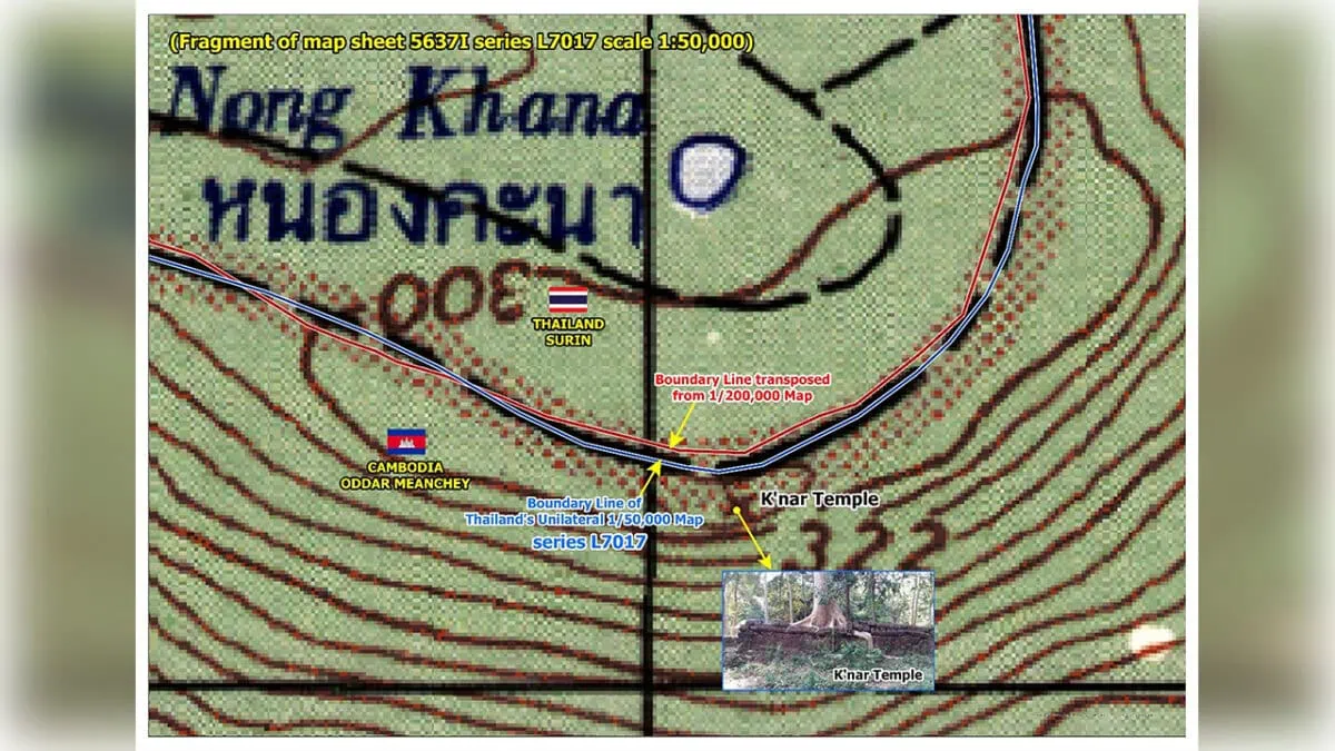 - The boundary lines of a unilaterally drawn Thai map show that Khnar (K’nar) Temple is located in Cambodia. Supplied.
#National
The Khnar Temple, in Oddar Meanchey province, has been occupied by Thai forces since last December. A senior border official has highlighted that even the unauthorised, unilaterally drawn maps used by Thailand clearly show that the temple is located within Cambodian territory.
According to the official, this confirms that the occupation of the temple is illegal.
In a June 27 interview with National Television of Cambodia (TVK), Ith Sotha, permanent secretary of state at the State Secretariat of Border Affairs (SSBA), explained that the 1:200,000-scale map created by the Franco-Siamese Boundary Delimitation Commission clearly shows that Khnar Temple is located within Cambodian territory.
“Here, we can demonstrate that Khnar Temple is located within Cambodian territory according to the boundary line shown on the 1:200,000-scale map. Here is a satellite image. The red line represents the boundary transferred from the 1:200,000-scale map, while the blue line represents the boundary shown on Thailand’s unilaterally drawn 1:50,000-scale map, which Thailand has consistently used,” he explained, alongside a graphic which overlaid the border lines of both maps.
Khnar Temple is located in O’Teuk Chol village, of Samraong town’s Kon Kriel commune, opposite Thailand’s Kap Choeng district, in Surin Province.
Before the 2025 conflicts, Cambodians often climbed the 1,181 steps of a wooden walkway to worship at the temple. Now, with access cut off by Thai forces, civilians from the neighbouring Kingdom are reportedly visiting the temple, prompting protests from Cambodia.
Sotha explained that the Cambodia–Thailand international boundary was established in the early 20th century through boundary delimitation and the placement of 73 boundary markers. The process was based on conventions, treaties, maps, pillar records and other documents, as well as physical demarcation on the ground carried out by the French authorities representing Cambodia at the time and Siamese authorities, now Thailand.
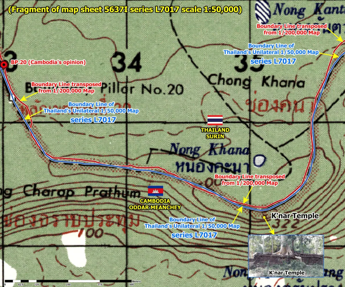
“This map shows the location of Boundary Marker No. 20, marked in red. The original boundary marker has been displaced, and its current location remains unknown. During the first phase of the joint search for the original French-era boundary marker, both sides attempted to locate it,” he noted.
According to Sotha, Cambodia determined that the marker’s original location corresponds to the red point on the map above, which lies directly on the red boundary line transferred from the 1:200,000-scale map. It is also located very close to the blue line representing Thailand’s position.
He noted that the temple’s location can clearly be seen on a current satellite image, with boundary lines — the Cambodian position shown in red and the Thai in blue — indicating that the temple lies within Cambodia.
“Even Thailand’s own unilaterally drawn 1:50,000-scale map supports this conclusion. This extract is taken from Map Sheet No. 5637 I, Series L7017, which Thailand has used for its unilateral boundary claims,” he said.
“We have overlaid Cambodia’s boundary line in red on the map, while the blue line is the boundary already shown on the 1:50,000-scale map. It clearly demonstrates that Khnar Temple is located within Cambodian territory,” he added.
According to the official, the L7017 map was produced unilaterally by Thailand. The map, which is not recognised by the UN, shows that Khnar and Tamone Thom temples, as well as several others along the border, are located within Cambodian territory.
“At present, the Thai military is attempting to draw a new boundary line that will incorporate illegally occupied land into Thai territory,” he said.
-Phnom Penh Post-