Recent statements by Thai military officials deserve international attention. Rather than rebutting Cambodia’s concerns over armed aggression, they appear to provide new evidence of what Cambodia has consistently warned against: the use of military force to establish facts on the ground based on Thailand’s unilateral 1:50,000-scale maps.
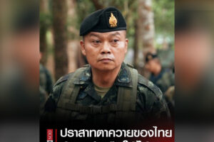
According to the Thai military’s own account, Thai forces drove Cambodian soldiers from positions along the cliff and “completely seized” areas along the Preah Vihear front following the two rounds of armed hostilities. The reported reference to the 1:50,000 scale is particularly significant.
It raises a simple but fundamental question: Can a state draw its own map, claim territory according to that map, use military force to seize and control that territory and then present the resulting military occupation as proof of sovereignty?
The answer is no.
International boundaries cannot be rewritten through unilateral cartography, and military control cannot transform a territorial claim into lawful title.
Cambodia Stands on Treaties, Not Unilateral Maps
Cambodia’s position rests on a legal framework established more than a century ago through the Franco-Siamese Convention of 13 February 1904 and the Franco-Siamese Treaty of 23 March 1907, together with the work of the boundary commissions and the maps associated with that delimitation process, including the relevant 1:200,000-scale maps.
This is not a boundary framework Cambodia invented recently. It is part of the historical and legal architecture governing the frontier inherited by Cambodia and Thailand.
Its significance is reinforced by the International Court of Justice. In 1962, the Court ruled that the Temple of Preah Vihear was situated in territory under Cambodian sovereignty and required Thailand to withdraw forces stationed at the Temple or in its vicinity on Cambodian territory. The Court’s 2013 interpretation further clarified Cambodia’s sovereignty over the territory of the Preah Vihear promontory addressed by the judgment.
Cambodia therefore relies on treaties, established boundary instruments and international law — not on a line drawn unilaterally for contemporary military purposes.
The 2000 MoU Reinforces This Legal Framework
Thailand cannot credibly dismiss this treaty-based framework because it reaffirmed it bilaterally with Cambodia.
Under the 2000 Memorandum of Understanding on the Survey and Demarcation of Land Boundary, Cambodia and Thailand agreed to undertake boundary survey and demarcation jointly, with reference to the 1904 Convention, the 1907 Treaty and the relevant documents and maps resulting from the work of the boundary commissions established under them.
The logic is unmistakable: boundary questions are to be resolved jointly through agreed legal mechanisms-not unilaterally through military force.
If either side could simply produce its own 1:50,000 map, declare its line to be the international boundary and send troops to enforce it, the 2000 MoU and the Joint Boundary Commission would become meaningless.
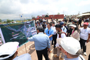
Thailand may produce maps for its own administrative or military purposes. But a unilateral map is evidence of Thailand’s territorial claim; it is not, merely by its existence, proof of an internationally binding boundary accepted by Cambodia.
Thailand’s Statement May Be Evidence Against Its Own Narrative
This is why the latest Thai military statement is so important.
Thailand repeatedly describes its operations as defensive, necessary, proportionate and consistent with international law. Yet its own military officials are reportedly describing how Thai forces drove Cambodian soldiers from positions and “completely seized” areas along the battlefront.
If those advances were undertaken according to Thailand’s unilateral 1:50,000 interpretation, the statement raises a serious question: Was armed force used to impose a territorial claim that Cambodia had never accepted?
If so, Thailand’s own words become important evidence concerning the nature and purpose of its military operations.
A battlefield advantage is not a boundary settlement. Military control is not a treaty. And armed occupation cannot manufacture sovereignty.
Article 2(4) of the UN Charter prohibits the threat or use of force against the territorial integrity or political independence of any state. Territorial disputes must therefore be addressed through peaceful mechanisms, not by creating faits accomplis on the ground.
The international community should carefully document what Thai military officials themselves are saying: where their forces advanced, which positions they seized, which forces they expelled and what cartographic basis they relied upon.
If Thailand believes its territorial interpretation is legally correct, it should defend that position through the mechanisms established for peaceful boundary settlement.
What cannot be accepted is a formula of draw the line unilaterally, advance militarily to that line, remove the other side, establish control and then use that control as evidence of sovereignty.
Cambodia remains committed to the 1904 Convention, the 1907 Treaty, the relevant 1:200,000 maps and boundary documents, the ICJ judgments and the bilateral mechanisms established under the 2000 MoU.
The principle is straightforward
No unilateral 1:50,000 map can, by itself, establish or alter an international boundary. No military operation can transform a unilateral territorial claim into lawful title. And no fact created through force can erase a century-old treaty-based boundary framework.
Treaties define boundaries. Unilateral maps do not. Force cannot redraw them.
Roth Santepheap is described as a Phnom Penh-based geopolitical analyst. The views and opinions expressed are his own.