Thailand’s Own Military Map Confirms Tamone Thom Temple Lies Inside Cambodia sovereignty
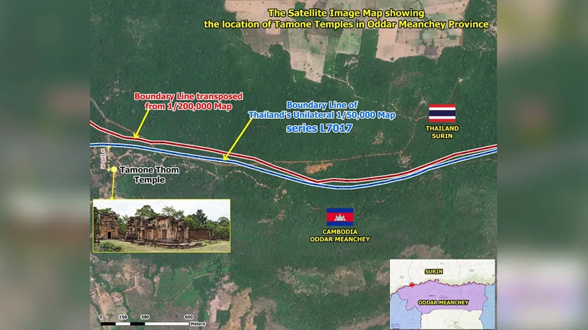 - Both French colonial era-maps and Thailand’s unilaterally drawn ones show that Tamone Thom Temple is located within Cambodia. SSBA
Thailand’s own L7017 military map, in addition to the internationally recognised 1:200,000-scale map produced by the Franco-Indochina–Siam Boundary Commission, places Tamone Thom Temple within Cambodian territory, according to a senior Cambodian border official.
The 11th-century Khmer temple along the Dangrek Mountains is currently under illegal occupation by the Thai military following two rounds of military aggression against Cambodia in July and December, despite strong condemnation and repeated protests by Cambodia.
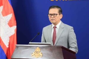
Speaking in an interview with state broadcaster TVK, Ith Sotha, Permanent Secretary of State at the State Secretariat of Border Affairs (SSBA), said both historical and technical evidence confirm Cambodia’s sovereignty over the ancient temple despite Thailand’s continued occupation of the area.
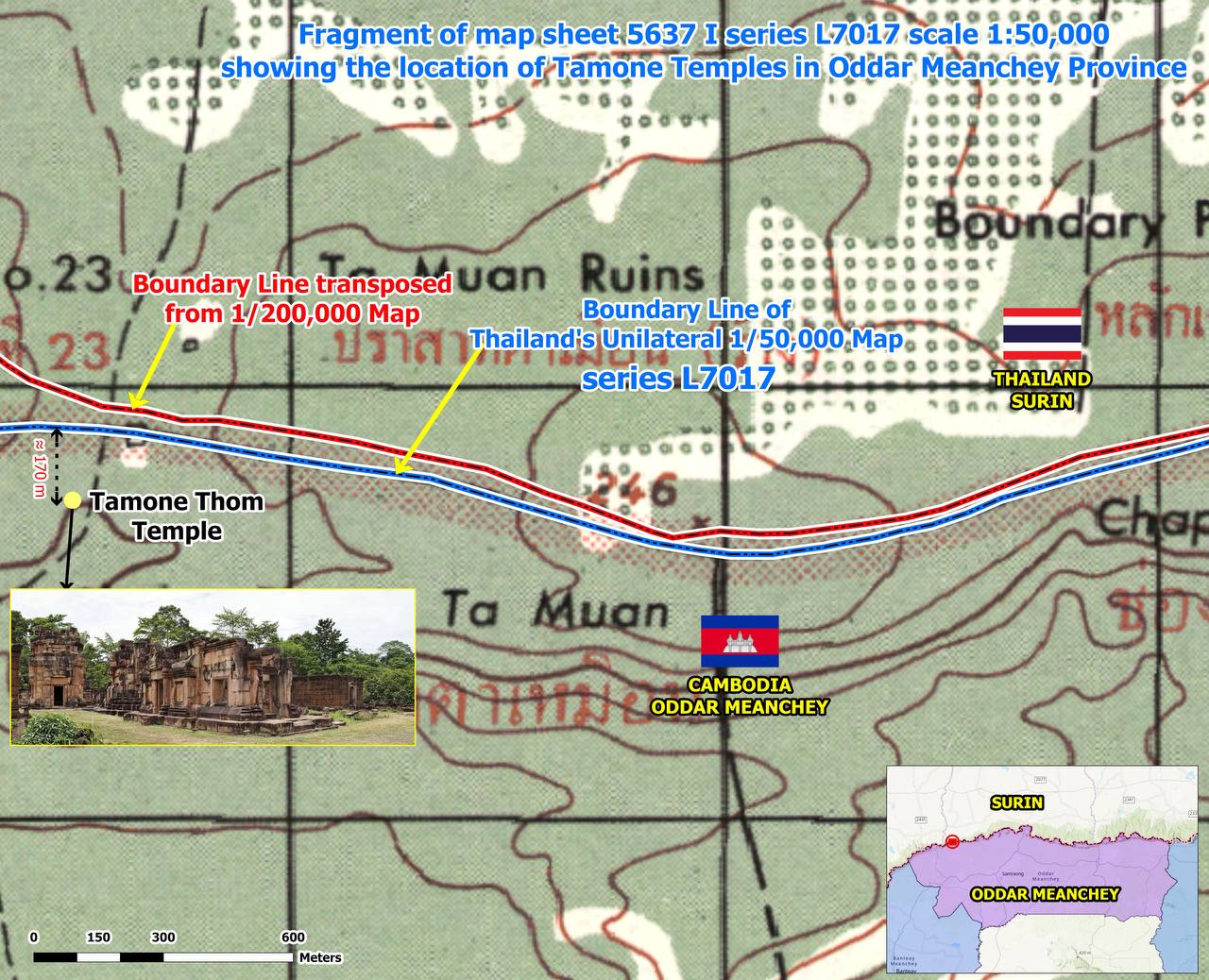
Sotha said the conclusion is supported by the 1:200,000-scale map produced during the Franco-Indochina–Siam Boundary Commission’s demarcation work, as well as Thailand’s own L7017 map at a scale of 1:50,000 prepared by the Royal Thai Survey Department.
He explained that the boundary reproduced from the internationally recognised 1:200,000-scale map, together with the unilateral boundary line shown on Thailand’s L7017 map, clearly indicates that Tamone Thom Temple is situated within Cambodian territory.
“It is also very clear that Tamone Thom Temple is located within Cambodian territory,” he said.
To support his explanation, he referred to satellite imagery showing the temple’s location and said the images could be enlarged to clearly identify the site.
He also cited the Indications Topographiques (Topographic Indications Map), an annex to the survey records of the Franco-Indochina–Siam Boundary Commission in 1908, which he described as additional documentary evidence confirming the temple’s location.
According to Sotha, the map identifies Khmer temple ruins in the area and corresponds with the findings of the Cambodia-Thailand Joint Survey Teams during fieldwork to locate Boundary Marker No. 23.
He said the historical records and the joint field survey provide documentary and factual evidence supporting Cambodia’s sovereignty over Tamone Thom Temple.
“I would like to reiterate once again that Tamone Thom Temple is situated within Cambodian territory, based on the 1:200,000-scale map and the Indications Topographiques map, which were jointly produced by the French and Siamese authorities during the border demarcation work in 1908,” he said.
Sotha further argued that Thailand’s continued reliance on newly drawn boundary lines has no legal standing.
“Although Thailand is now attempting to draw a new boundary line in order to incorporate areas that it has invaded and illegally occupied into Thai territory, such maps cannot be regarded as having any legal validity or legal effect,” he said.
– Khmer Times-